Views
Views are interpretive historical visualizations from my research. Each view aims to address or illustrate a research question or theme.
 Landscapes of the Bay Area
How did the landscapes of the Bay Area overlap? This map depicts the overlapping Natural, Urban, and Industrial landscapes of the Bay Area.
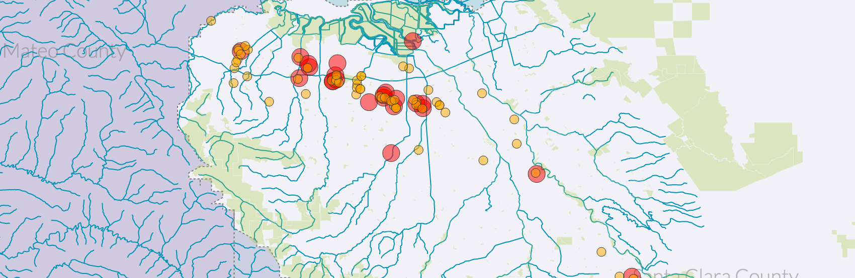
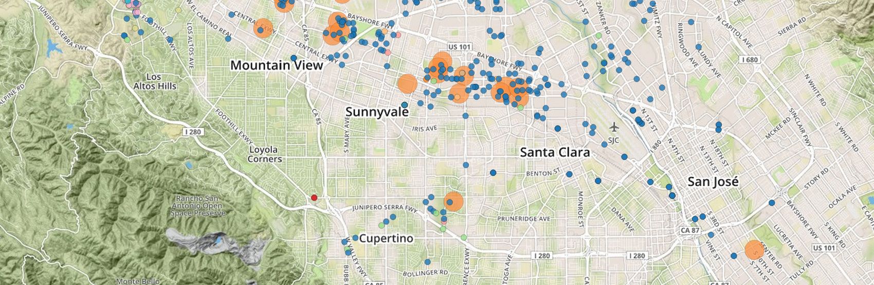 The Pollution Landscape, 1970—2000
In 1982 news broke that Fairchild Semiconductor's manufacturing facility in South San Jose had leaked industrial solvents into the soil and groundwater, affecting nearby drinking wells operated by the Great Oak Water Company that supplied 16,000 residents. By the end of the decade, numerous leaks, spills, and contaminations would be uncovered.
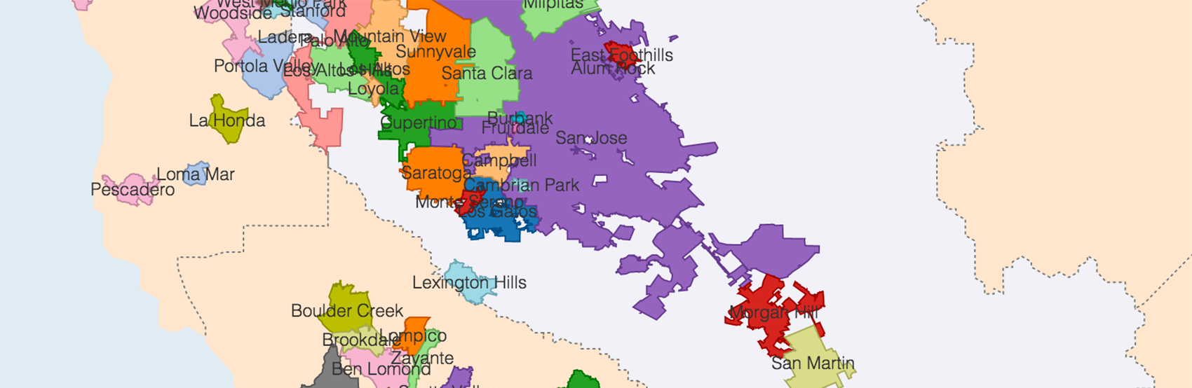
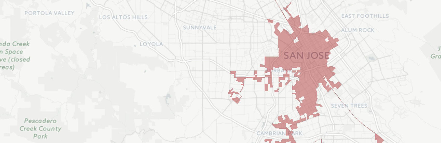 San Jose Annexations, 1850—2010
After 1945, the City of San Jose embarked on an aggressive annexation campaign in the Bay Area with the intent of becoming the "Los Angeles of the North."
 Conservation Lands in Santa Clara County
The protected lands of Santa Clara County are administered by various local, regional, and federal agencies. The interactive map shows which areas of the land are administered by particular agencies.
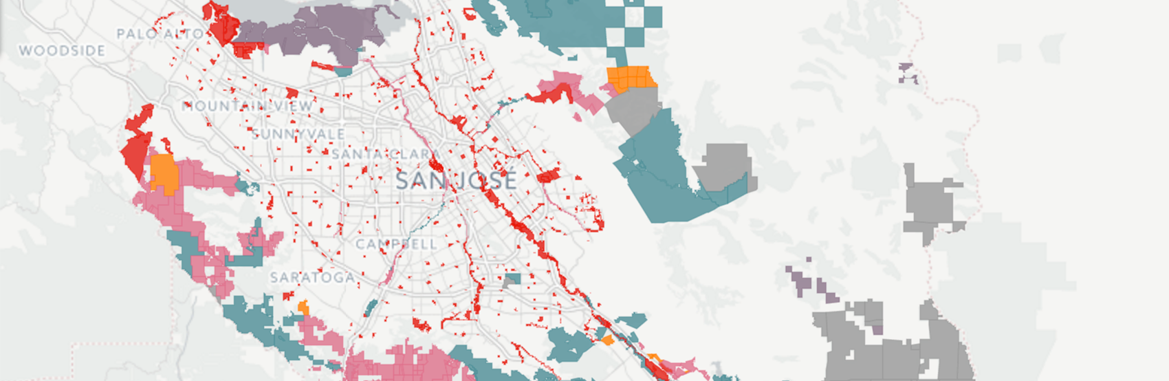
 Urban Areas of the San Francisco Peninsula
After 1945, every municipality in the Bay Area underwent aggressive expansion. Annexations, incorporations, and consolidations created a sprawling, complicated map of urban areas on the Peninsula.
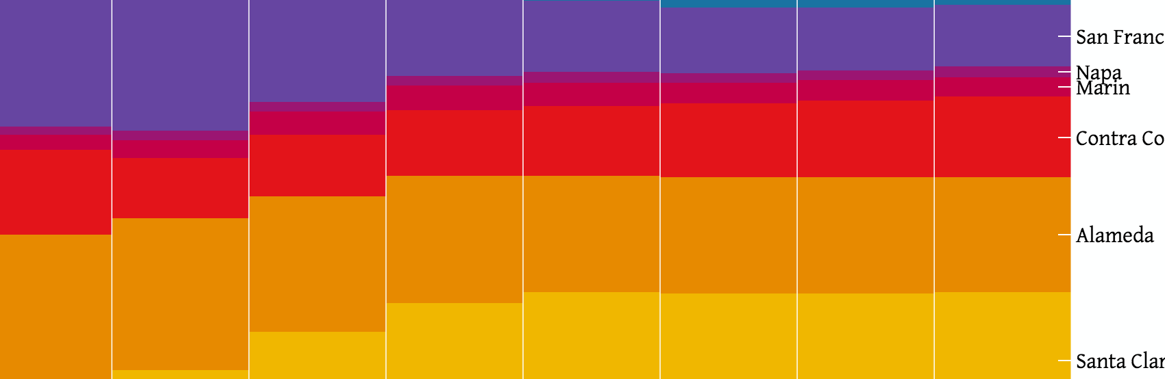 Population Growth of the Bay Area, 1940—2010
In the postwar era, the Bay Area's population expanded rapidly as migrants came to California to work in new defense industries and take advantage of new suburban opportunities.
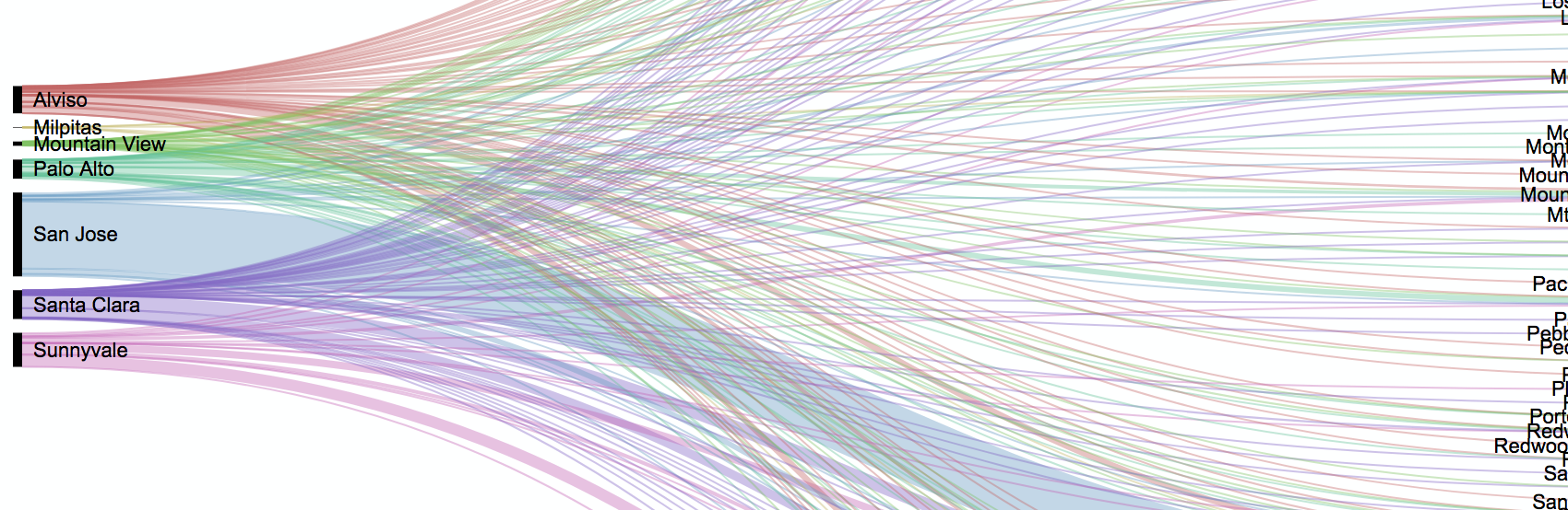 Journey-to-Work in the Bay Area, 1958
A key criticism of conservationists and environmentalists in the Bay Area focused on the massive uptick in traffic that resulted in smog obscuring the views that many residents enjoyed. Here is a snapshot of where people were commuting from in order to visually understand the traffic flow between suburban homes and suburban offices.